Welcome to Advanced GIS, Lecture 1
This is a web page that can be viewed as slides.
→ to move forward
← to go back
Advanced GIS
Advanced GIS
for International Crises, Development and the Environment
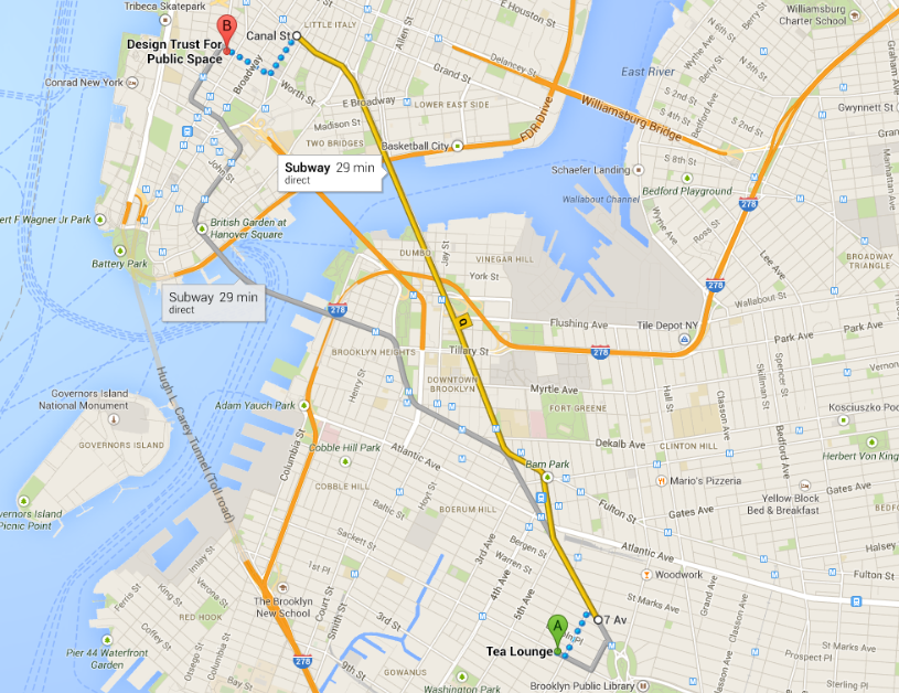
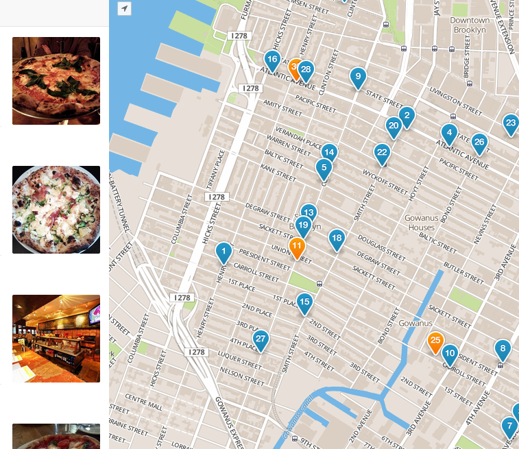
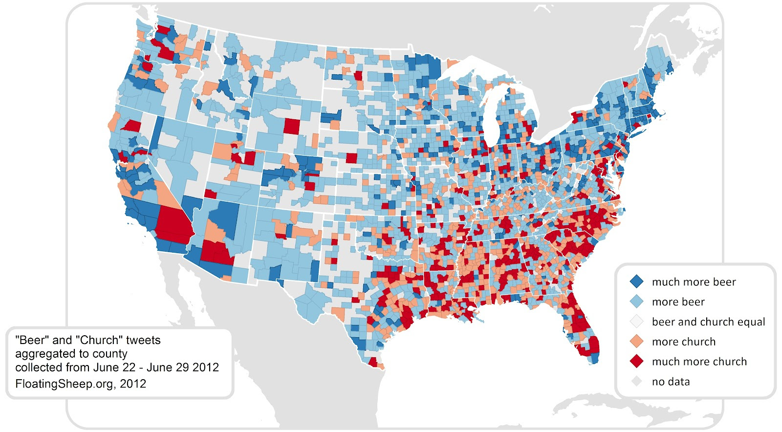
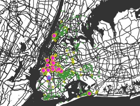
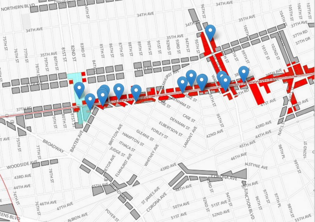
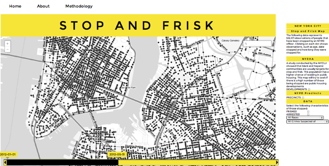
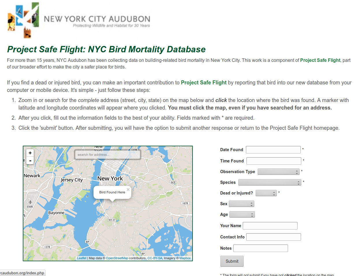
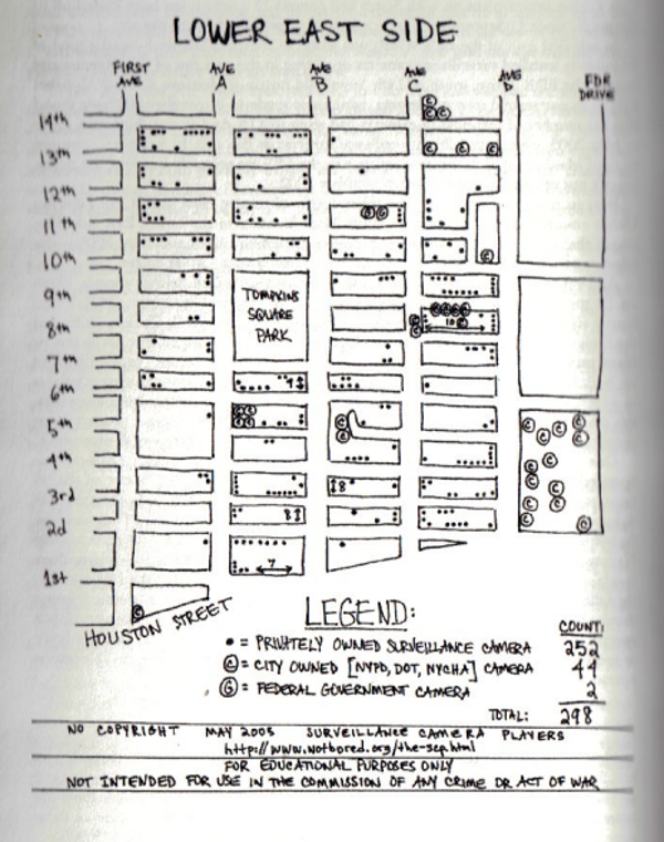
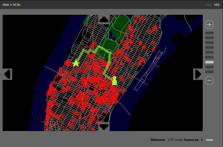
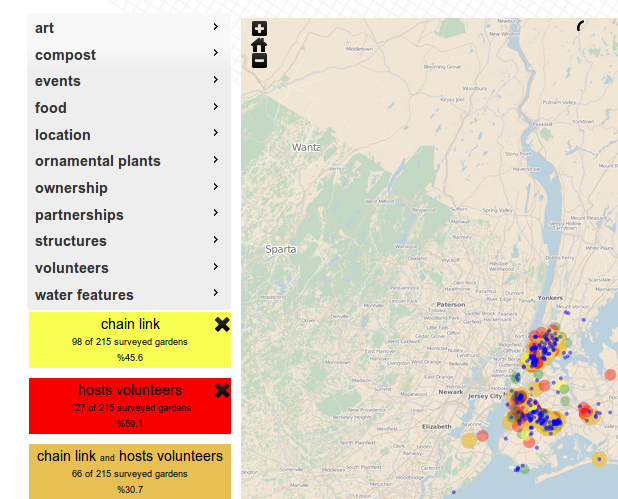
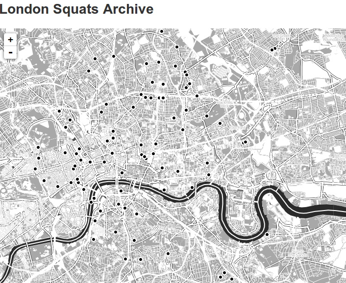
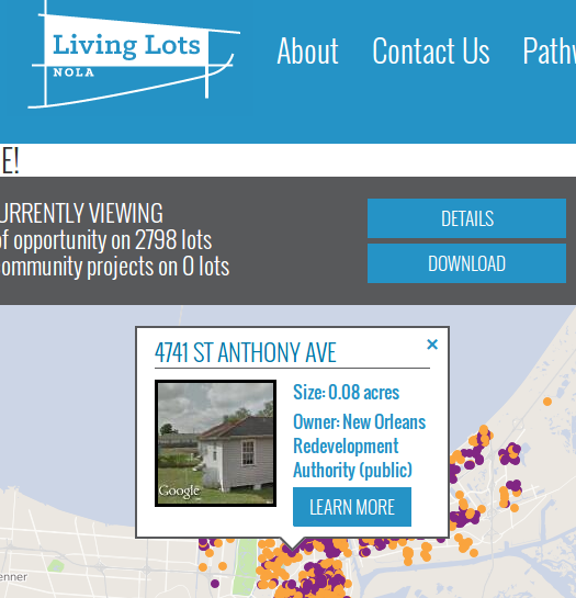
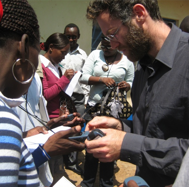
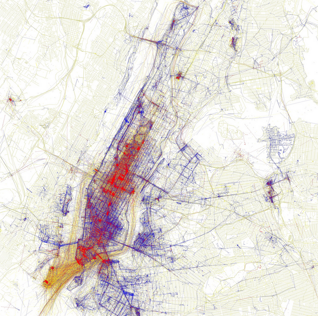
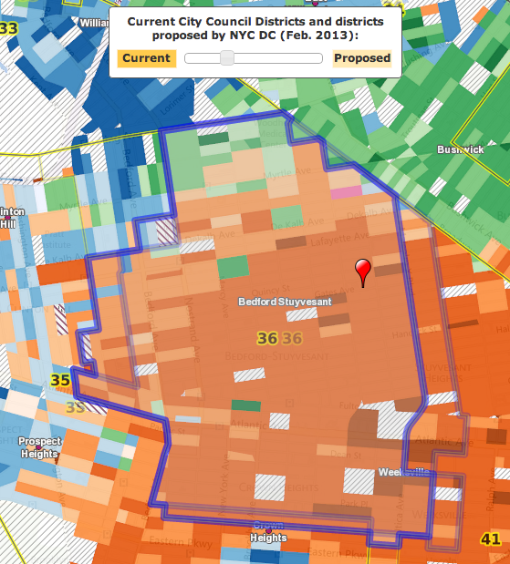
maps that I've made
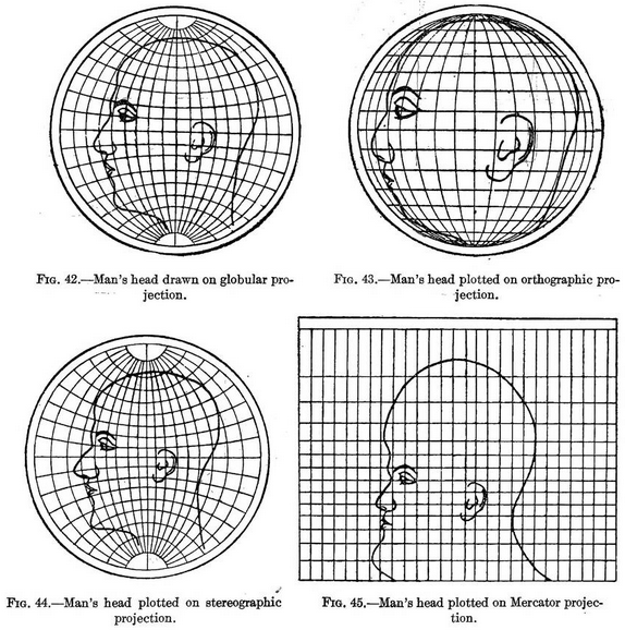
Refreshers
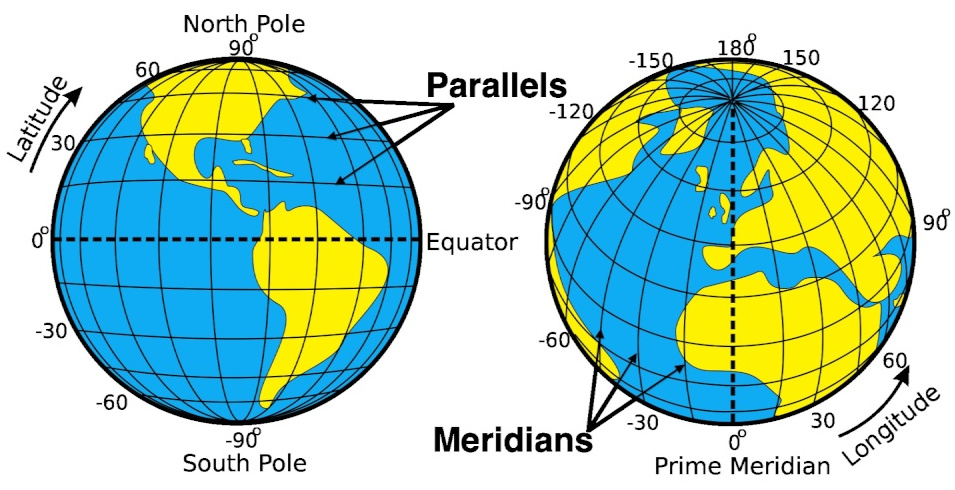
latitude and longitude
raster

vector
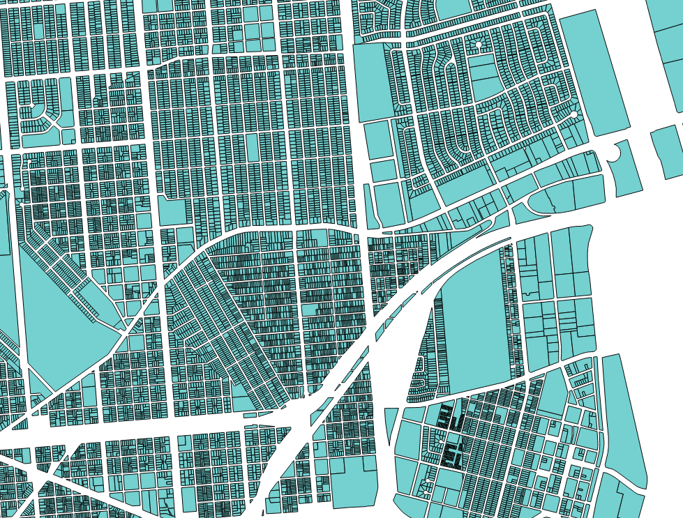
vector
Geographic Information System
Geographic Information Systems

Geographic Information Systems

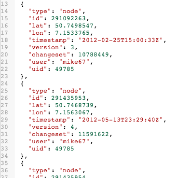
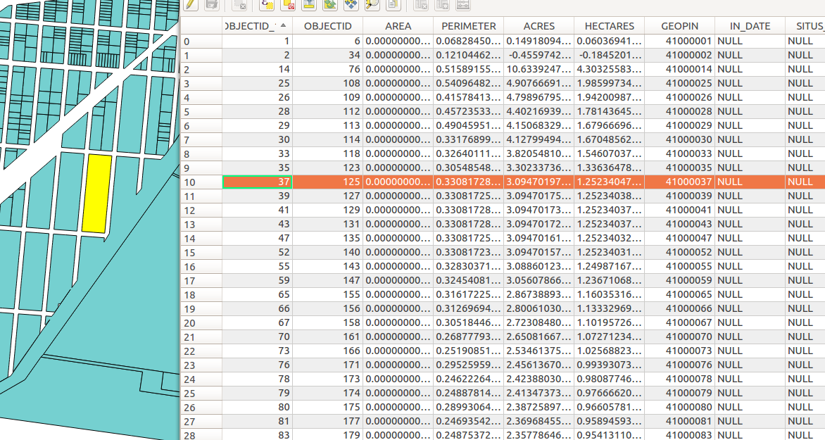
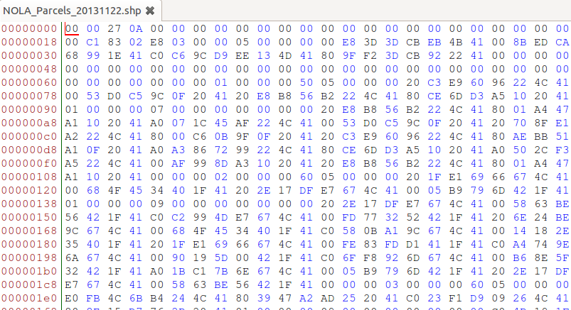
shapefile
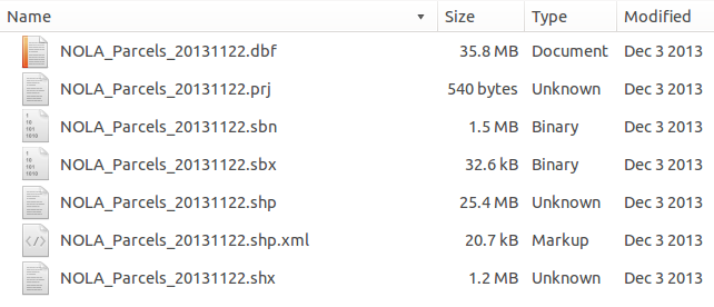
shapefile
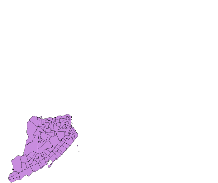
clipping
clipping
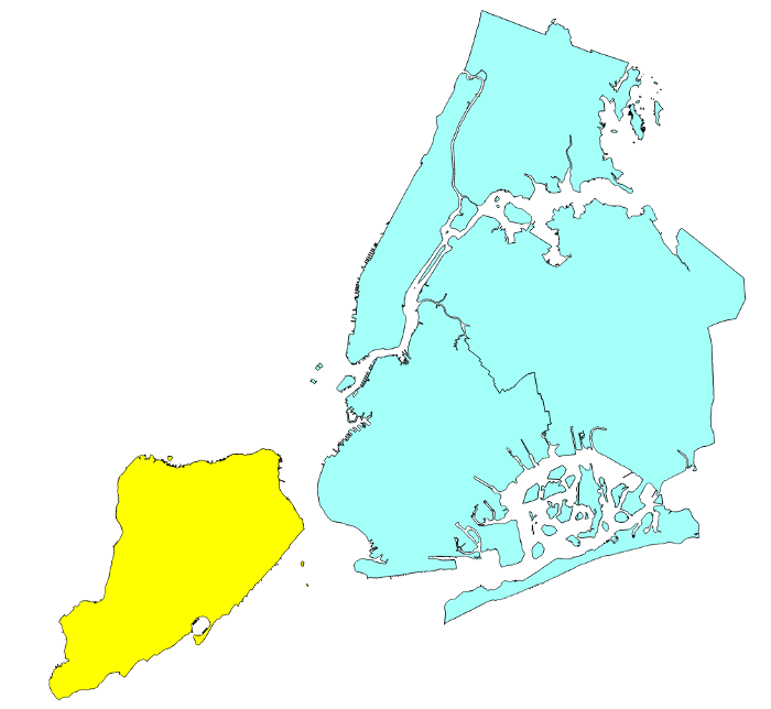
clipping
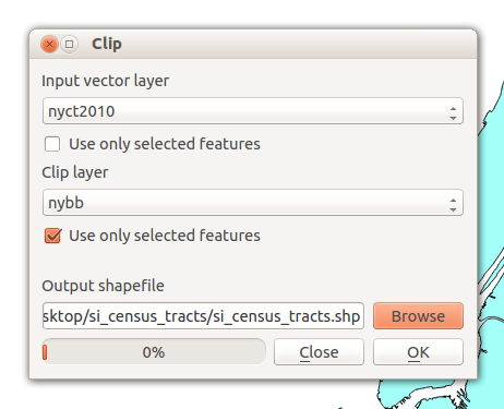
clipping
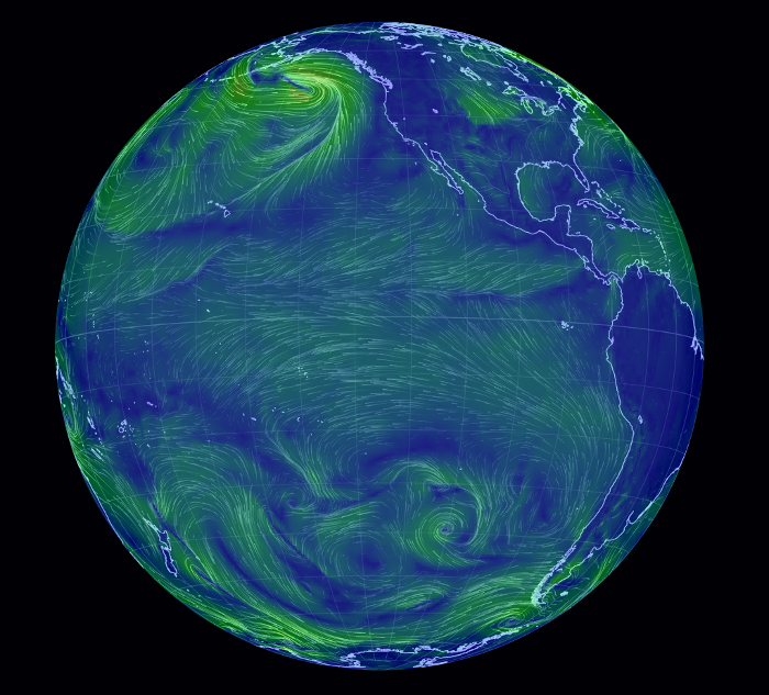
What do you think of when you think of a "modern" map?
Introduction to the geoweb
"geoweb", AKA:
- new spatial media
- neogeography
- new spatial media
- neogeography
- locative media
- new spatial media
- neogeography
- locative media
- DigiPlace
- new spatial media
- neogeography
- locative media
- DigiPlace
- geocollaboration
- new spatial media
- neogeography
- locative media
- DigiPlace
- geocollaboration
- map hacking
geoweb
geoweb
the set of practices and software that bring maps to the web and the maps that are their outcomes
"practices and software"
platforms for working with maps and data
adding spatial data to otherwise non-spatial artifacts
(eg, geotagging of pictures on a service like flickr, adding location to tweets, etc)
"practices and software"
- platforms for working with maps and data
- (open) data
- adding spatial data to otherwise non-spatial artifacts
How did we get here?
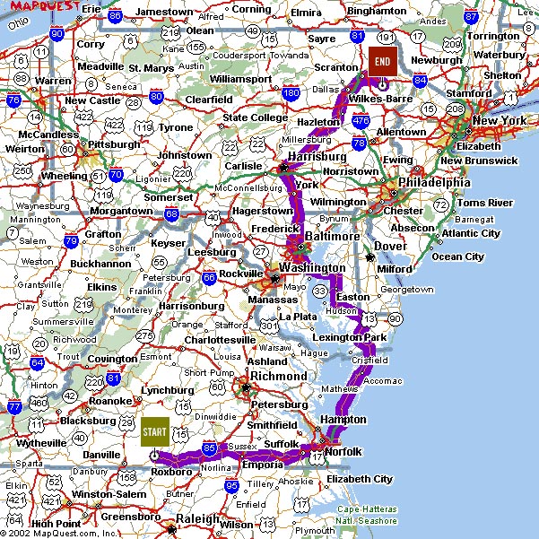
first web maps were static
click
...wait
entire page reloads,
map is panned east
static online maps are often indistinguishable from paper maps
What has changed since 1997?
~1997 - today
- GPS
- the web changed
- more data became available
- FOSS became mainstream
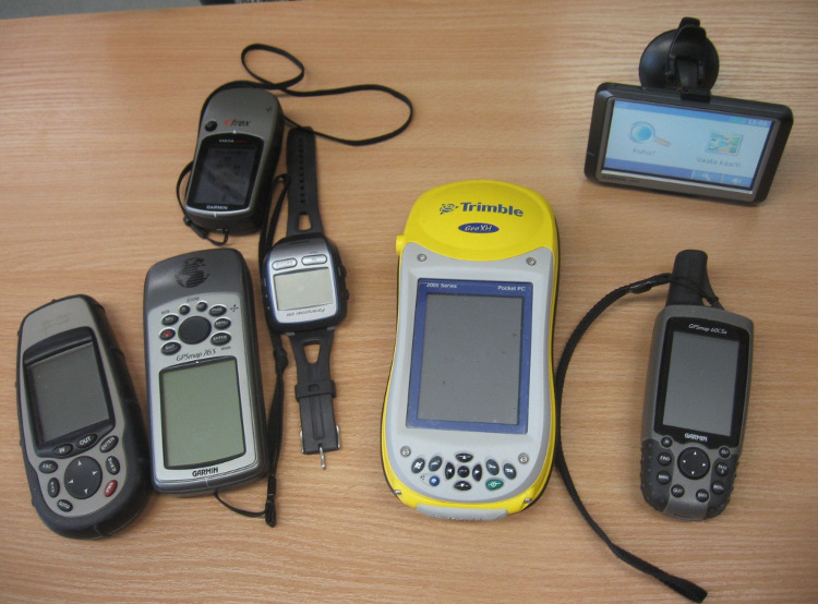
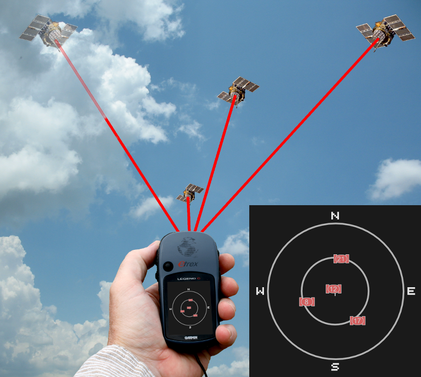
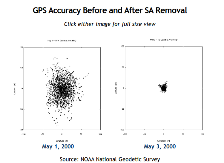
1. GPS
GPS "selective availablility" turned off (2000)
2. the web has changed
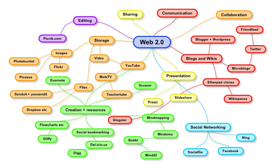
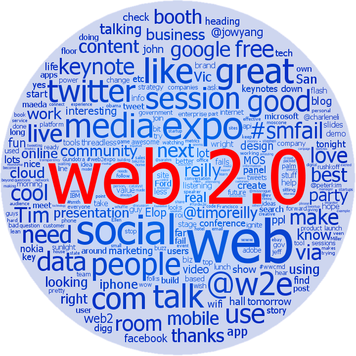
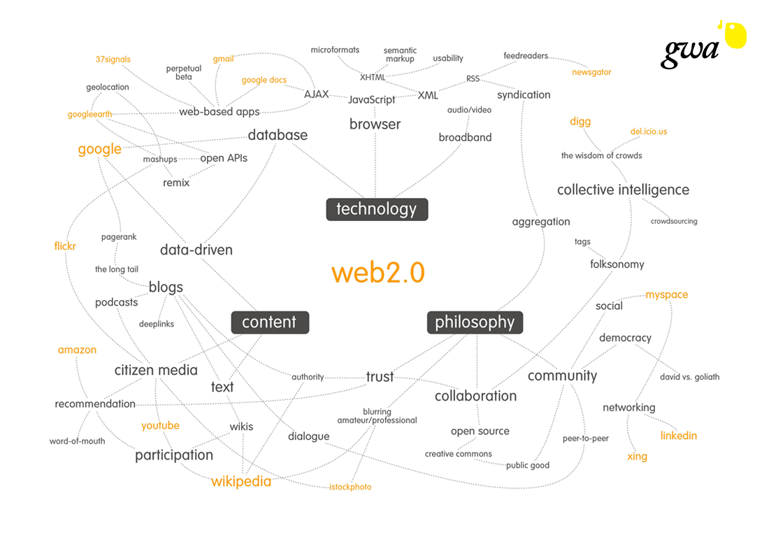
"Web 2.0" (~2004)

Tim O'Reilly
- Britannica Online → Wikipedia
- Britannica Online → Wikipedia
- publishing → participation (podcasting, blogging, etc)
- Britannica Online → Wikipedia
- publishing → participation
- content management systems → wikis
- Britannica Online → Wikipedia
- publishing → participation
- content management systems → wikis
- directories → tagging
- Britannica Online → Wikipedia
- publishing → participation
- content management systems → wikis
- directories → tagging
AJAX (2005)
AJAX
(Asynchronous Javascript and XML)
AJAX
(Asynchronous Javascript and XML)
dynamically loading portions of webpages
AJAX
not really new, but newly articulated
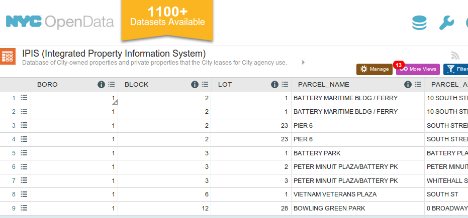
3. data becomes more available
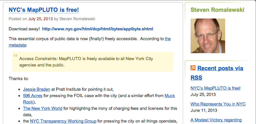
open data
collaborative data
4. open source
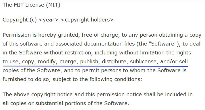
Free and open source software (FOSS)
goal is to protect the "fundamental freedoms of software users"
source code
freedoms to
- use,
- study,
- modify, and
- redistribute
source code
in exchange for
- attribution, and sometimes
- sharing your changes under the same license
backed by licenses
backed by licenses

Linux taken seriously by Microsoft (~1998)
"Recent case studies (the Internet) provide very dramatic evidence
... that commercial quality can be achieved / exceeded by OSS projects."
leaked internal Microsoft memo
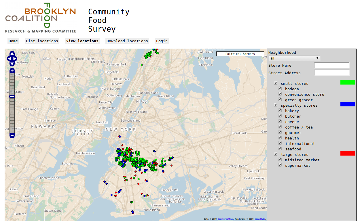
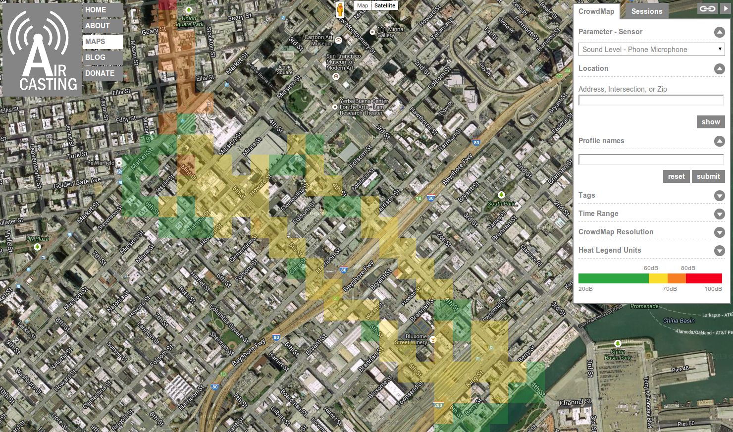
Anatomy of a web map
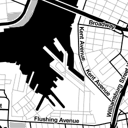
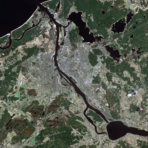
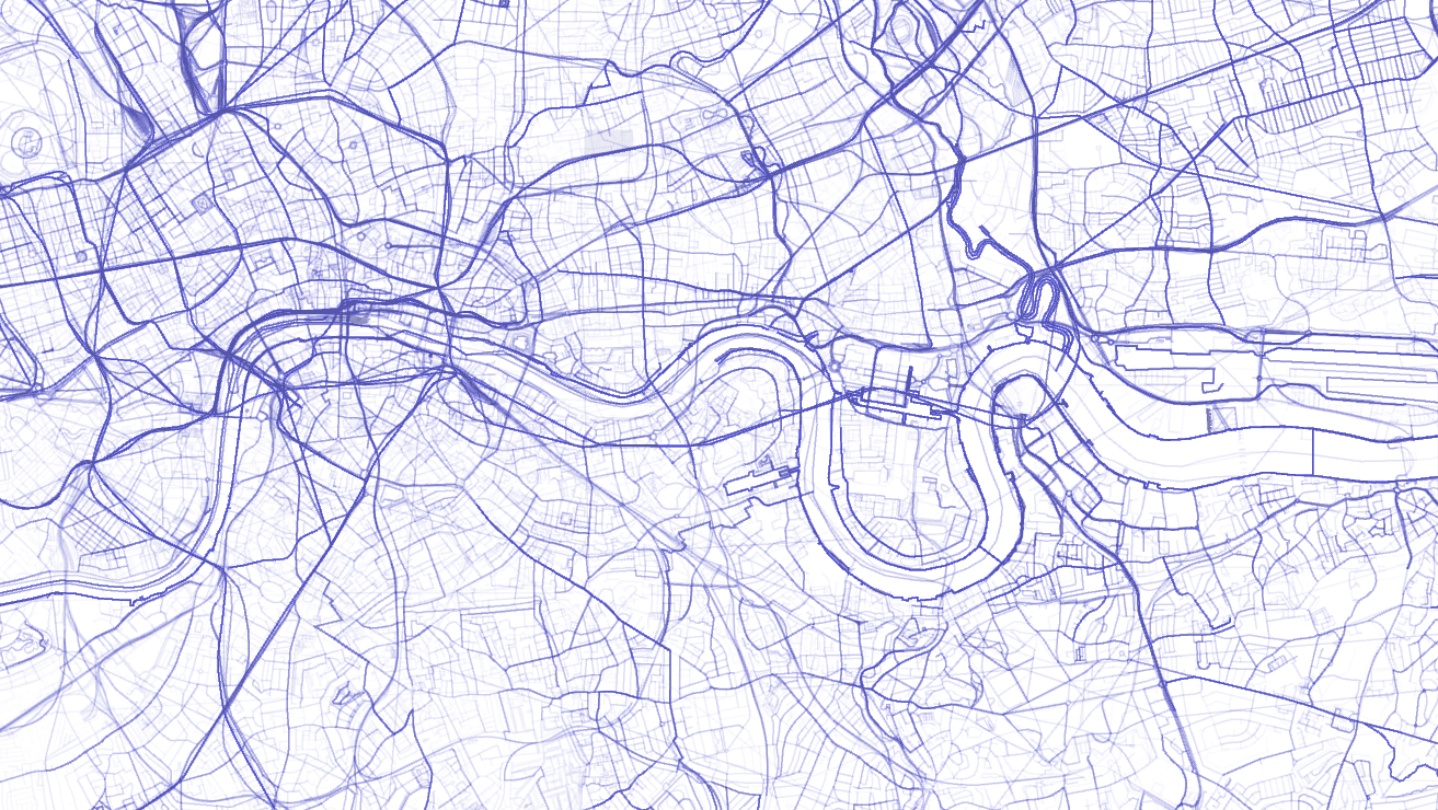
2. Make or reuse base tiles
Street, water and land data
Street, water and land data →
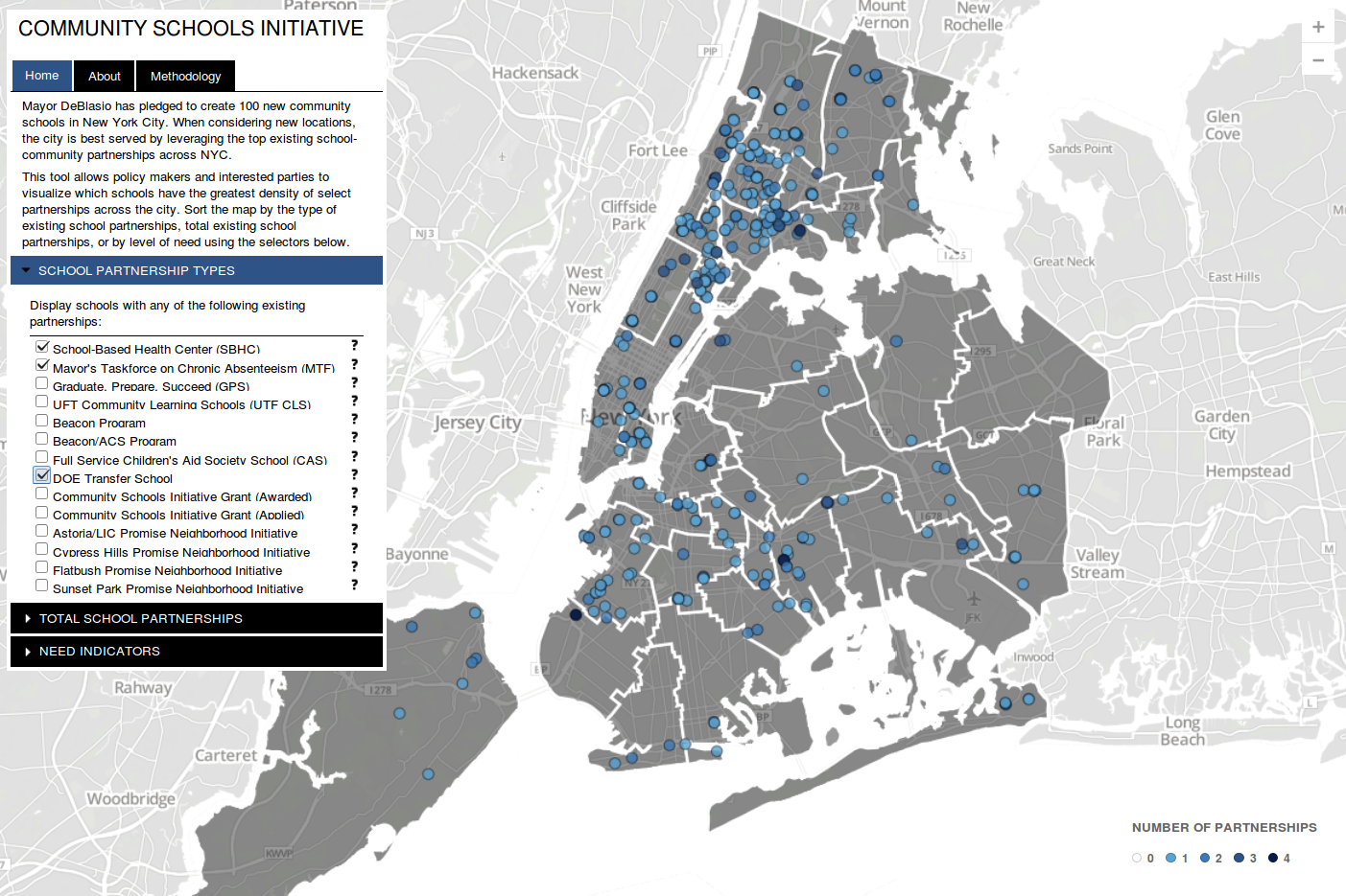
4. Mix with some html, css, and javascript
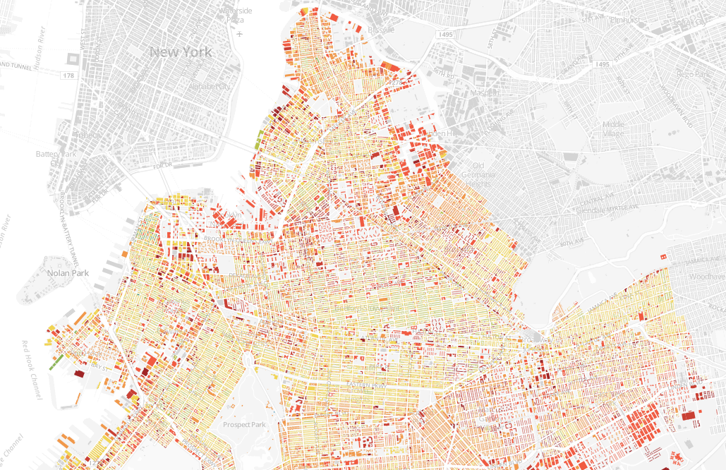
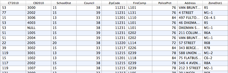
1. Start with some data
2. Make or reuse base tiles
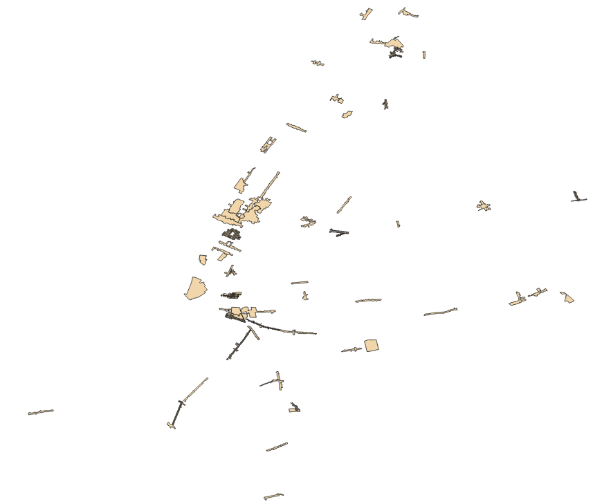
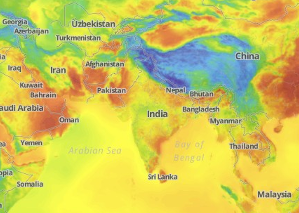
3. Overlay data
4. Mix with some html, css,
and javascript
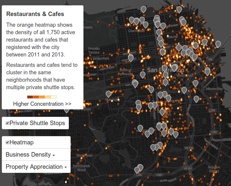
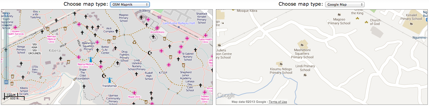
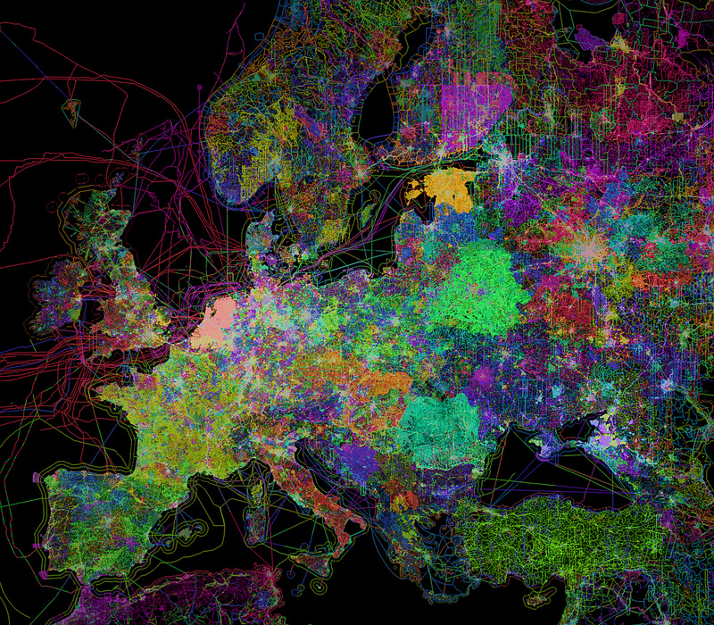
geoweb maps
Haiti in OpenStreetMap before 2010 earthquake
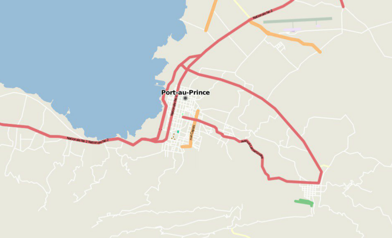 source
Haiti in OpenStreetMap after 2010 earthquake
 source
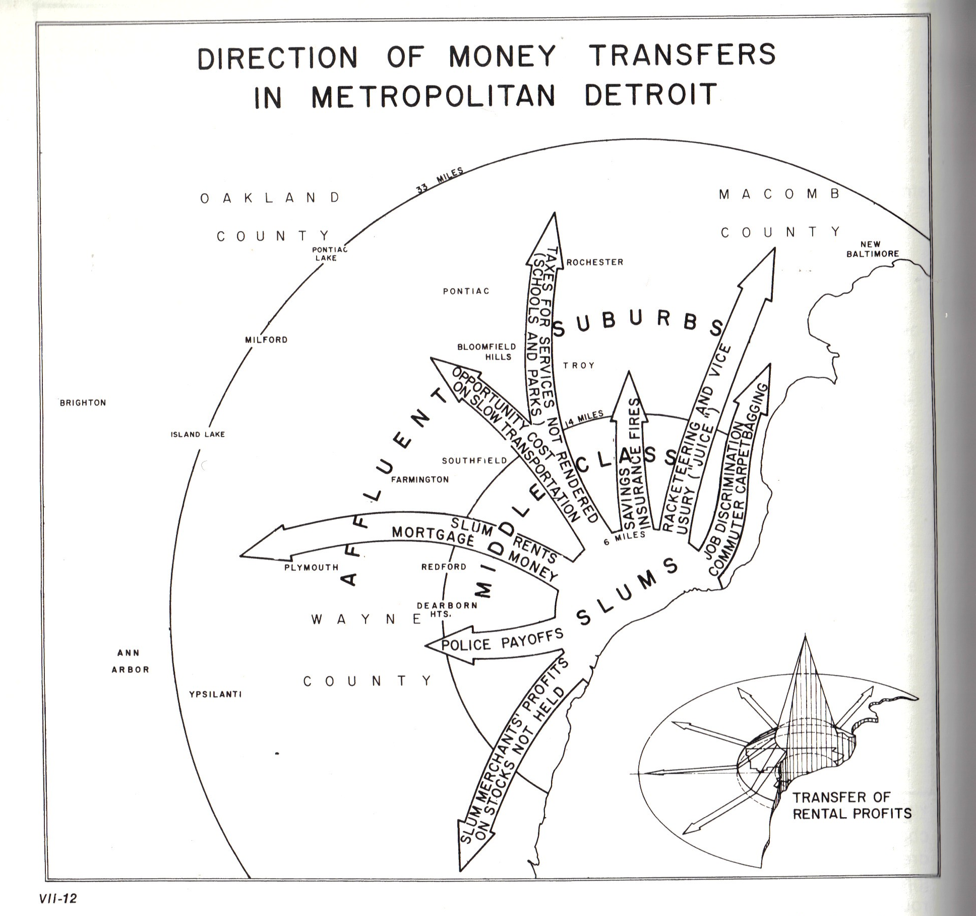 Bill Bunge