Welcome to Advanced Interactive Web Mapping, Programming, and Design, Class 1

This is a web page that can be viewed as slides.

→ to move forward

← to go back

Advanced Interactive Web Mapping, Programming, and Design

Class 1

living lots nyc
urban reviewer
osm
maptime

Where we're heading

ArkGIS
Inside AirBnB

HTML

<p>
    <a href="...">Link One</a>
</p>
<p>
    <a href="...">Link Two</a>
</p>
<a href="...">Link Three</a>
<div id="map">
</div>

CSS

how would you style only links in paragraphs here?

<p>
    <a href="...">Link One</a>
</p>
<p>
    <a href="...">Link Two</a>
</p>
<a href="...">Link Three</a>

JavaScript

var points;
var points = [];
var points = {};

events

event listeners

leaflet

var map = L.map('map');

JSON

SQL

in-class exercise, part 1

CartoDB

The L Train closure—what data can tell us
github.com/CartoDB/cartodb

"free as in speech"

cartodb.com

"free as in beer"

Who uses CartoDB?

source
Bumpiness in NYC
Vital Signs
source

datasets

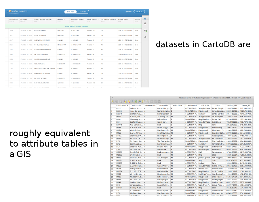
where you import, edit, and analyze your data

you can upload:

maps

where you make public map views of your tables

in-class exercise, part 2